Route 21: The Cades trail
UZER
Route 21: The Cades trail
Medium
3h15
8,7km
+248m
-253m
Loop
PR
Embed this item to access it offline
Set off on a sunny hike from Uzer and discover the Gras plateau, a limestone landscape dotted with Mediterranean vegetation. Along the way, don't miss the Tombe du Géant, a dolmen dating from the Neolithic period, before reaching a lookout point offering a breathtaking view of the Tanargue. This exploration offers spectacular panoramas and encounters with the past, making for an unforgettable experience.
Description
Leaving the recreation area: Take the path up to the left of the recreation area.
1. Les Blaches: [La Drayette 1.2 km, Balazuc 5 km] Cross the voie verte and continue uphill. At the crossroads, turn right.
2. Les Blaches-Hautes: [La Drayette 1 km, Balazuc 4.8 km] This path, lined with box trees, offers a lovely view of the Ligne valley and its villages. Continue along the hillside path.
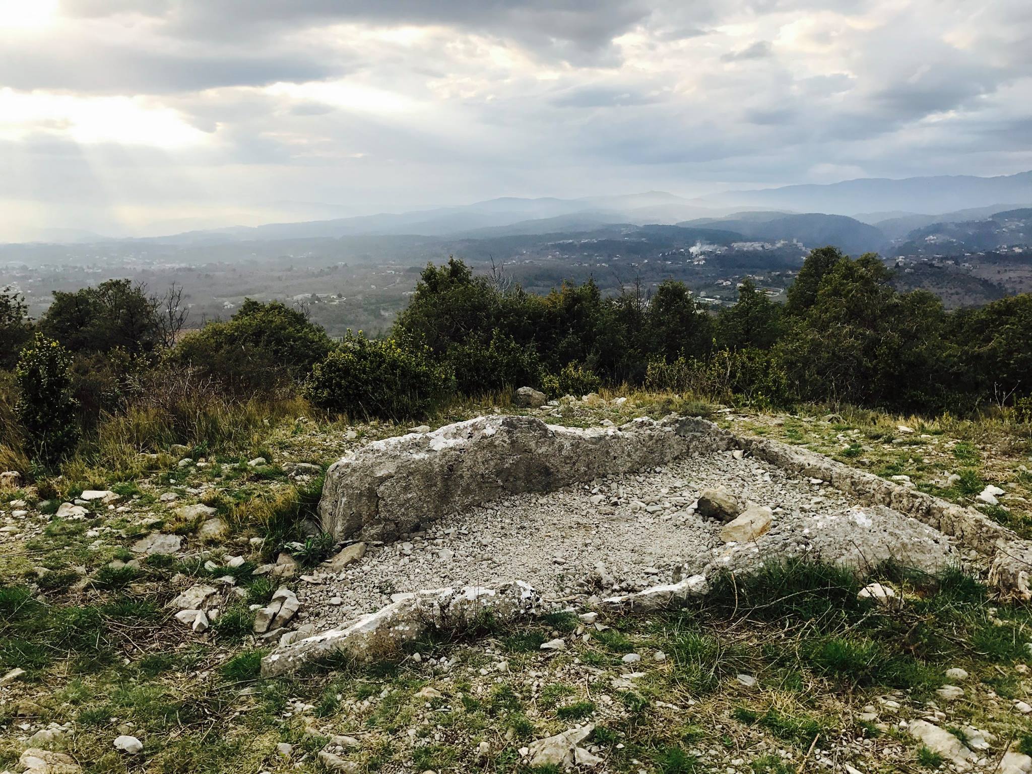
3. La Drayette: [Chauzon par les crêtes 6.7 km] At the crossroads, turn right. After climbing for a few minutes, follow the winding path to the right that leads to the Ranc de la Bade viewpoint. Retrace your steps for a few metres, then turn right onto the hillside path. There are views of Uzer, Largentière, Chassiers, Montréal, Sanilhac, Tour de Brison, Serre de Barre and Mont Lozère. When you reach the summit, turn left and a few metres further on you will see the Tombe du Géant dolmen, of which only the base remains. Continue to the left, the path descending into a combe.
4. Le Gras: [La Drayette 1.4 km, Uzer 3.2 km] At the fork in the road, turn left. The track crosses ancient terraces. After about 800m, fork left and follow the track to the crossroads.
3. La Drayette : [Uzer 1.8 km] Take the track on the right.
2. Les Blaches-Hautes : At the junction, you have two options:
Shorten the walk by retracing your steps in the direction of [Uzer 0.8 km]
Continue the walk by turning left in the direction of [Uzer 2.6 km]. Follow the hillside path that joins the road. At the La Prade Haute crossroads, turn right, cross the river and follow the road to the right as far as the village. At the entrance to Uzer, continue to the right, passing the castle. Go up to the square, down the stairs to the right and then to the left, passing under the porch. Turn left, pass the church and rejoin the D104. Continue on your right for 80 metres, then turn right to reach the leisure area.
- Departure : Aire de loisirs, Uzer
- Arrival : Aire de loisirs, Uzer
- Towns crossed : UZER, BALAZUC, and CHAUZON
Forecast
Altimetric profile
Recommandations
Déconseillé en cas de fortes chaleurs. Peu d'ombre.
Information desks

Office de tourisme du Val de Ligne
3 rue du Maréchal Suchet,, 07110 Largentière
Transport
Ligne E13 ou 74
Access and parking
In Uzer, follow ‘Aire de loisirs’ and ‘Via Ardèche’.
Parking :
Aire de loisirs, Uzer
More information
Report a problem or an error
If you have found an error on this page or if you have noticed any problems during your hike, please report them to us here: