Route 22: Discovering the Gras plateau
UZER
Route 22: Discovering the Gras plateau
Medium
5h
14km
+388m
-388m
Loop
PR
Embed this item to access it offline
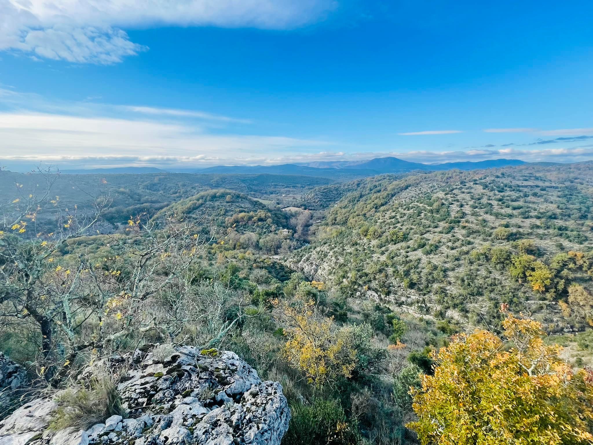
Set off on an enchanting hike from Uzer to Chauzon, across the Gras plateau. Soak up the Mediterranean vegetation and savour the panoramic view of the Tanargue and the majestic Ardèche river. Along the way, discover the mystery of the Tombe du Géant dolmen.
Description
Leaving the recreation area: Take the path up to the left of the recreation area.
1. Les Blaches: [La Drayette 1.2 km, Balazuc 5 km] Cross the voie verte and continue uphill. At the crossroads, turn right.
2. Les Blaches-Hautes: [La Drayette 1 km, Balazuc 4.8 km] This path, lined with box trees, offers a lovely view of the Ligne valley and its villages. Continue along the hillside path.
3. La Drayette: [Chauzon par les crêtes 6.7 km] At the crossroads, turn right. After climbing for a few minutes, continue along the winding path on the right that leads to the Ranc de la Bade viewpoint. Retrace your steps for a few metres, then turn right onto the hillside path. There are views of Uzer, Largentière, Chassiers, Montréal, Sanilhac, Tour de Brison, Serre de Barre and Mont Lozère. When you reach the summit, turn left and a few metres further on you will see the Tombe du Géant dolmen, of which only the base remains. Continue to the left, the path descending into a combe.
4. Le Gras: [Faussimagne 4.2 km, Chauzon 4.4 km] At the crossroads, carry on past the ruin and continue along the wide track, which becomes a path lined with boxwood, oak and juniper trees and mingling with the scent of thyme. Follow the Gournier stream for 1.5 km, from which you can enjoy some lovely views.
5. La Hâle: [Chauzon 1.8 km] At the fork in the road, continue straight ahead. Along the snetier, you will see ancient low walls and blocks of stone carved out by the waters. After 1 km, continue along the road, passing a few houses. At the crossroads, turn right, follow the "any direction" sign and follow the route des Gras as far as Place des Blaches (info rando Chauzon).
6. Chauzon: Take the route des Blaches on the left and continue along the main rue Etienne Georges. Go through the centre of the village and take the old chemin d'Uzer on the left. Drive past the boulodrome, then turn right at the roundabout. A few metres after the bend in the road, a footpath leads to the Beaussements lookout (viewpoint over the Ardèche). Continue along the road and after 400m, take the path on your right towards the Belvédère des Aulagniers. Continue until you reach the road, walk along it for 20m then take the path opposite. After about 100m, keep to the left as the path descends for a few metres, then turn left. You will come to a tarmac track, continue until you come to a fork in the road.
7. Audon : [La Drayette 1.9 km, Uzer 3.7 km]
8. Lubac : [La Drayette 1.8 km, Uzer 3.6 km]
9. Combe Veyras: [La Drayette 0.6 km, Uzer 2.4 km] At the crossroads, continue. Cross the road and continue along the wide path to the crossroads.
3. La Drayette: [Uzer 1.8 km] Take the same path back to the recreation area.
- Departure : Aire de loisirs, Uzer
- Arrival : Aire de loisirs, Uzer
- Towns crossed : UZER, BALAZUC, and CHAUZON
Forecast
Altimetric profile
Recommandations
Déconseillé en cas de fortes chaleurs. Peu d'ombre.
Information desks

Office de tourisme du Val de Ligne
3 rue du Maréchal Suchet,, 07110 Largentière
Transport
Ligne E13 ou 74
Access and parking
In Uzer, follow ‘Aire de loisirs’ and ‘Via Ardèche’.
Parking :
Aire de loisirs, Uzer
More information
Report a problem or an error
If you have found an error on this page or if you have noticed any problems during your hike, please report them to us here: