Route No. 1: Between the Ligne River and the Lande river
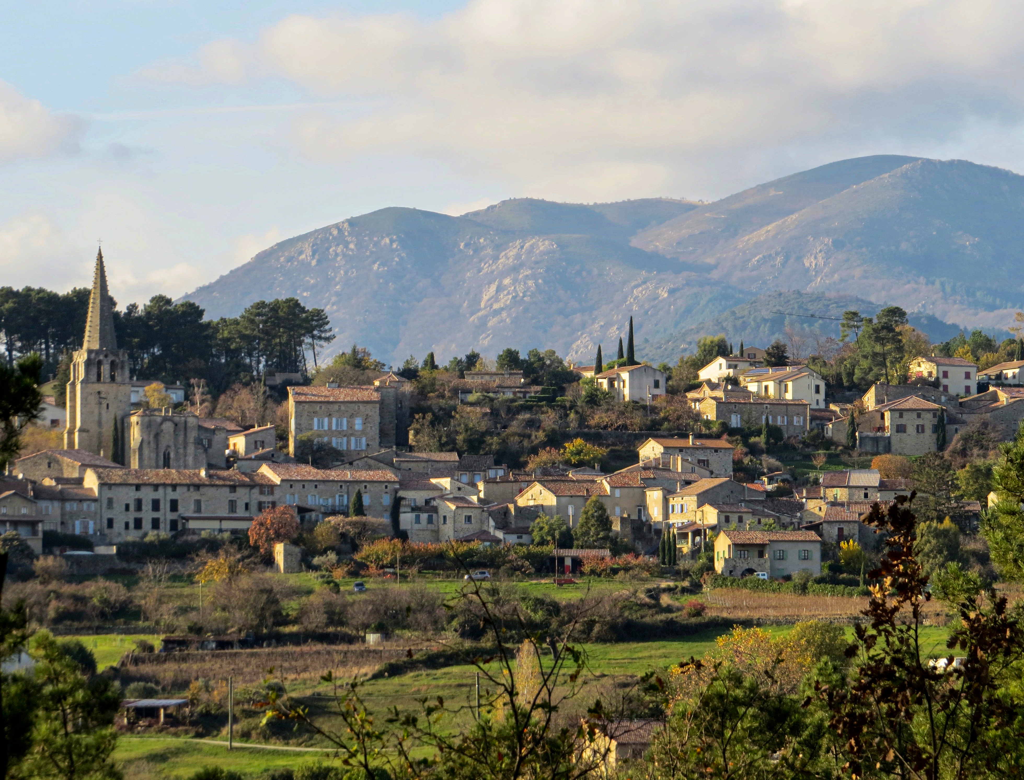
CHASSIERS
Route No. 1: Between the Ligne River and the Lande river
Hard
5h15
17,1km
+625m
-627m
Loop
PR
Embed this item to access it offline
You will pass through many hamlets, between the Ligne and Lande rivers, and walk near terraces and old chestnut groves. The start and end point is the characterful village of Chassiers, where heritage and vineyards meet. This hike will lead you to the Virgin of Ranc Courbier, a summit offering a panoramic view over the entire Val de Ligne.
Description
Start from the school square: Take the path that descends below the cemetery and crosses terraced gardens. Follow the path downhill, then continue along a cobbled path and turn left. The trail reaches a house; go straight ahead. The path descends steeply through terraces and joins the GR de Pays Tour du Tanargue.
Les Fourniols: [Joannas 4.5 km] You follow the GRP Tour du Tanargue for about 1.2 km, overlooking the granite gorges of the Ligne river.
Bastide: [Saint-Joseph Chapel 1.3 km] At the junction, leave the GRP. Turn right, the cobbled paths lead you to the hamlet of Coulens. Follow the road on the right, then take the path to the right.
Saint-Joseph Chapel: [ND de Bonne Rencontre 3.6 km] At the intersection, follow the road for 350 meters, then take the path to the right.
Les Combes: You have two options:
Take the variant [Chassiers 4.7 km] on your right (7.9 km loop): follow the path descending through the vineyards. At the road, turn right onto the paved path, then follow the road to Davalade until the junction “Les Valadiers.” This brings you directly to step 10.
Do the full 16.2 km loop: Turn left toward [ND de Bonne Rencontre 3.1 km – Rocher 6.7 km], cross the hamlet of Les Combes and continue for 400 m. Turn right, passing an old pink sandstone quarry. Pass Mas d’Eyrou; at the Croix de Couderc pass, continue along the Flachères path.
ND de Bonne Rencontre: [Le Vaure 1.9 km] At the junction, turn left on the road, then right, and take the cobbled path on the left just before the large gate. In the hamlet of Joux, turn left toward Le Vaure 1.5 km – Rocher 3.1 km. Follow the path through the chestnut grove, climbing up to the Virgin of Ranc Courbier.
Virgin of Ranc Courbier: Go back down the same path to the chapel, then turn left toward [Chassiers 7.7 km].
La Rouvière: [Chassiers 7.3 km] Cross the road and take the trail on the right that climbs behind a house. Cross the hamlet of Davalade, then the road, and continue on the descending path (paved for a few meters) to Mas de Lauche. Continue on the cobbled path leading to the D223.
Moulin de Lande: Follow the road to the right toward [Chassiers 5.1 km]. After 150 m, take the path that climbs to the right.
Les Valadiers: [Chassiers 2.8 km] Follow the road for 400 m, then take the cobbled path descending on the left. Then turn left and right onto a paved road that becomes a dirt path; enjoy the view over the village of Chassiers.
Les Juliennes: Turn right toward [Chassiers 1.2 km] and take the trail that descends to the bridge, follow the road for 200 m and continue on the cobbled path that climbs toward the village. Cross the village to reach the parking area.
- Departure : Place de l'école, Chassiers
- Arrival : Place de l'école, Chassiers
- Towns crossed : CHASSIERS
Forecast
Altimetric profile
Recommandations
Parcours déconseillé par forte chaleur.
Information desks

Office de tourisme du Val de Ligne
3 rue du Maréchal Suchet,, 07110 Largentière
Access and parking
From Largentière, follow the direction to Chassiers. Drive through the village of Chassiers following the sign for “école” (school). Park in the school’s parking lot.
Parking :
Place de l'école
More information
Report a problem or an error
If you have found an error on this page or if you have noticed any problems during your hike, please report them to us here: